

Public Outreach
VRPA Technologies offers services for creating and building partnerships, supporting the exchange of ideas and information among interested individuals and groups and resolving conflicts and challenges.
Services Offered:
Public Outreach and Education Programs for Transportation Projects (all modes)
Public and Stakeholder Meetings, Hearings, Workshops & Interviews
Meeting Facilitation
Speakers’ Bureau
Partner Agency and Technical Presentations
Door-to-Door Contact (Business and Resident)
Focus Groups
Public Service Announcements
Project Branding and Websites
Radio, Newsprint, and Online Advertising
Educational Videos, Surveys and Questionnaires
Projects
-
The Madera Rail Corridor Improvement Study is evaluating seven at-grade crossings along the Union Pacific Railroad (UPRR) corridor in the City of Madera. The Study will primarily focus on potential grade separation solutions at Yosemite and Cleveland Avenues; however, priority will be given to identifying complimentary safety improvements to address conditions at multiple at-grade crossings along the UPRR corridor. The project team’s responsibilities include conducting a rail safety planning study, engaging stakeholders, and performing an alternatives analysis. As a subconsultant to HNTB, VRPA is leading the Stakeholder Coordination Plan and the Transportation Technical Analysis as part of the Alternatives Analysis/Project Planning Package.
VRPA’s responsibilities on this project include the following:
Identify key agency stakeholders.
Identify community stakeholders.
Define coordination and outreach methods.
Develop public engagement procedures.
Establish documentation and comment-tracking procedures.
Prepare outreach schedule and milestones.
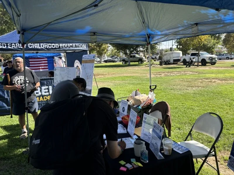
Conduct agency briefings, pop-up events, stakeholder workshops and public information sessions.
Coordinate bilingual public outreach as appropriate.
Collect and analyze traffic volume data.
Evaluate pedestrian and bicycle activity.
Analyze traffic operations and intersection performance.
Evaluate queuing and delay associated with rail operations.
Assess emergency response accessibility.
Forecast future transportation conditions.
Conduct transportation analysis for study alternatives.
Perform microsimulation analysis where warranted.

-
Public Outreach for Design Services for Merced to Madera (M2M)
VRPA is providing public outreach services for the Design Services for Merced to Madera project. VRPA’s outreach responsibilities have included maintaining a stakeholder database, preparation of the Public Outreach and Communication Strategies document, and development of a property access training program. VRPA has also co-facilitated multi-county Farm Bureau and Water District status meetings, oversaw the distribution of the property owner noticing materials and the workshop noticing flyer, and participated in informational workshops in Merced, Chowchilla, and Fairmead.
Segment 6, Merced to Fresno Public Outreach Program
VRPA was retained as a contractor to assist with implementation of a public outreach and education program related to California High-Speed Trains in the Central San Joaquin Valley. VRPA was responsible for helping to design the outreach program prior to the vote on Proposition 1A in November 2008. VRPA presented information regarding the system to over 40 different stakeholder groups. In addition, VRPA was responsible for development of the Scoping Workshop for the HST Environmental Impact Report/Statement (EIR/EIS) conducted in March 2009. VRPA prepared an outreach list with over 4900 contacts including elected officials and stakeholders from Fresno, Kern, Kings, Madera, and Tulare Counties. VRPA continued to assist the Segment 6 team with outreach activities that led toward development and certification of the EIR/EIS.
*Photo Credit: California High-Speed Rail Authority

-
The Fresno Council of Governments (Fresno COG) conducted an Extreme Heat Analysis and Shade Adaptation Plan to address extreme heat in Fresno County, with a focus on residents that rely on walking, bicycling, and public transit. This initiative included an extreme heat vulnerability analysis to identify priority areas for projects based on risk and exposure factors. The vulnerability analysis examined factors such as transit dependency, projected temperature increases, existing health conditions, current tree canopy coverage, socioeconomic factors, and pedestrian/bicyclist traffic patterns. The project, launched in early 2025, was completed in September 2026. The plan can be used to inform General Plans and other long-range planning documents across Fresno County and guide the design of future transportation infrastructure. It identifies specific tree canopy and vegetative cover projects that can be incorporated into future capital improvement projects, with local jurisdictions able to apply for funding to implement these recommendations. Public outreach and transportation analysis services for this study were led by VRPA, in coordination with DUDEK and Fresno COG staff.
VRPA’s responsibilities on this project included the following:
Development of the Public Engagement Plan.
Identification of working group members and stakeholders.
Participation in working group meetings, material preparation, and meeting presentations.
Organization and participation in bilingual pop-up events, virtual workshops, and visual preference surveys.
Social media and email blasts to communicate about the project.
Development of the methodology for pedestrian and bicycle traffic analysis.
Support for the development of criteria to prioritize the five most important vulnerable active transportation corridors for near-term action based on technical analysis and public input.
Assisting with presentations made to Fresno COG’s Transportation Technical Committee (TTC), Policy Advisory Committee (PAC), and Policy Board.

-
The San Joaquin Council of Governments (SJCOG), in partnership with Caltrans Districts 4 and 10, is overseeing the development of a Flood Adaptation Strategy (FAS) for State Route 4 (SR 4) through the San Joaquin Delta River. The FAS will assess the impacts of flood events of the San Joaquin River Delta on evacuation routing and will generate a list of priority flood-resilient capital improvement projects that SJCOG, in partnership with Caltrans Districts 4 and 10, could program on SR 4. The purpose of the FAS is to build on SJCOG’s 2022 Regional Resiliency Implementation Plan and Adaptation Guidance to develop a data-driven investment strategy for SR 4 as it experiences increasing flood risk. The FAS will improve and enhance the resiliency of the regional transportation network to a flood event by ensuring the network can more easily absorb, recover from, and adapt to flooding events. In addition to promoting climate and infrastructure resilience, the FAS will also address public safety, economic resilience, and cost-savings in the region with a focus on public benefits. VRPA is leading stakeholder and public engagement services for this project in coordination with WSP and SJCOG staff. VRPA is also assisting with existing conditions analysis, consequence analysis, adaptation strategy development and alternatives evaluation.
VRPA’s responsibilities on this project include:
Design a comprehensive Stakeholder and Public Engagement Plan tailored to those living and traveling through the project area.
Update, expand, and maintain the project’s Stakeholder database listing.
Assist with the development of meeting agendas, PowerPoint presentations, and related materials for Working Group meetings.
Coordinate with SJCOG website developers to establish a two-way communication portal on the SJCOG website so that the project team can actively solicit, gather and manage feedback from the public, and in turn, provide official, timely responses.
Develop and distribute community surveys (online and in-person) to broaden participation and coordinate with the preparation of the Draft and Final Plan.
Analyze survey results for use in the planning process.
Prepare bilingual (English/Spanish) engagement materials to ensure equitable access to project information.
Organize and participate in pop-up events to introduce the planning process and share information with the community's diverse members.
Organize and host virtual workshops to seek stakeholder and public input on the draft alternatives.
Prepare the Engagement Synopsis Report, which will provide a summary of all engagement activities and outcomes.
Summarize travel volume and other characteristics from Caltrans and local travel demand models, as well as local evacuation plans, for incorporation into the overall Existing Conditions memo.
Lead the site visit of the SR 4 study corridor, including preparation and safety planning, and documentation for incorporation into the overall Existing Conditions memo.
Summarize potential evacuation needs, alternative travel patterns, and resulting system impacts.
Lead the adaptation strategy development for civil engineering and traffic/ITS improvement.
Lead traffic analysis of alternatives evaluation.
Provide clear description of geographic locations of improvements and order-of-magnitude cost estimates for each alternative evaluation.

-
The State Route (SR) 99 Comprehensive Multimodal Corridor Plan (CMCP) focused on identifying a broad range of multimodal opportunities for improving and enhancing the SR 99 corridor. An important goal during preparation of the SR 99 CMCP was to identify and develop a stakeholder-shared vision and implementation plan for the corridor that aligns with the State goals to reduce greenhouse gas (GHG) emissions, passenger vehicle miles traveled (VMT), and increase freight reliability and throughput for inclusive economic development. The SR 99 CMCP was developed in coordination with the California Department of Transportation (Caltrans) Districts 6, 10, and 3, building from efforts by all three Districts and drawing upon a rich inventory of previous and active planning efforts at the State, regional, and local levels. Public outreach services were led by VRPA in coordination with Jacobs Engineering and Caltrans staff.
VRPA responsibilities on this project included:
• Development of the Public Outreach and Engagement Plan (PEP).
• Maintaining and updating the listing of stakeholder contacts identified for engagement.
• Preparation of engagement activity materials, including flyers, brochures, PowerPoint slides, maps, and photographs.
• Coordination with regional and local agencies for dissemination of noticing materials.
• Attendance and participation in SR 99 CMCP Technical Advisory Committee (TAC) meetings.
• Development of informational project videos in both English and Spanish.
• Assistance and facilitation of two series of eight (8) regional workshops held via Zoom to gather input from a variety of stakeholders along and across SR 99 to identify how to make their trips safer, easier, and more reliable.